Hurricane Simon Pounds Mexico’s Pacific Coast Resorts and Towns
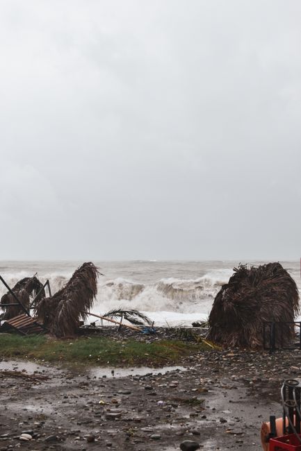
Storm Intensity and Projected Path
Hurricane Simon has intensified rapidly as it moves across the Pacific Ocean toward the Mexican shoreline. According to reports from NPR, the storm is expected to deliver winds reaching 155 mph as it approaches the coast. This intensity places the system in the upper range of hurricane strength, meaning the potential for structural damage is severe. Meteorologists are tracking the storm’s movement closely because the trajectory points directly at populated areas that have not always had the infrastructure to withstand such powerful winds.
The primary concern for emergency management officials is the combination of high wind speeds and the proximity of populated areas directly in the storm’s projected track. A storm of this magnitude does not merely bring rain; it brings a sustained force capable of tearing roofs off buildings and snapping power lines across wide areas. The National Hurricane Center and regional partners are issuing watches and warnings to ensure that communities have enough time to secure property and move to safety before the worst conditions arrive.
Wind Speeds and Structural Threat
Winds of 155 mph are capable of causing catastrophic damage to poorly constructed homes and significant damage to well-built structures. Debris becomes a major hazard in these conditions, as loose objects turn into projectiles that can shatter windows and compromise walls. This is why authorities emphasize securing loose items and boarding up windows well in advance of the landfall. The wind field of a hurricane of this size also extends far beyond the eye, meaning even areas slightly inland may experience damaging gusts.
The storm surge is another critical factor that amplifies the danger. As the low-pressure center passes over shallow coastal waters, it pushes water inland with tremendous force. This rising water can inundate streets and ground floors of buildings long before the wind arrives. Coastal communities must treat the surge as a primary threat, not just the wind, and evacuate low-lying areas immediately when ordered.
Landfall Timing and Coastal Exposure
The timing of the landfall is critical for evacuation planning. Reports indicate that two more landfalls are expected this weekend, both on Mexico’s Pacific coast. This means the region will face repeated exposure to high energy storms in a short window. Coastal towns that are already dealing with the effects of one storm may not have time to recover before the next system arrives. This clustering of events increases the overall risk to life and property and requires a sustained response from local and federal agencies.
Forecasters are monitoring the speed of the storm’s movement to determine how long the worst conditions will last. A slow-moving storm can dump more rain and keep winds high for a longer period, increasing the risk of flooding and wind damage. Residents should not assume the storm will pass quickly and should prepare for a prolonged period of hazardous weather that could last for several days.
Impact on Tourism and Coastal Infrastructure
Mexico’s Pacific coast relies heavily on tourism, and resorts are often the first economic victims of a major hurricane. High-end hotels and beachfront properties sit directly in the path of storm surge and wind, making them uniquely exposed to damage. When a storm of this size makes landfall, the damage to these facilities can be extensive, affecting everything from pool areas and landscaping to the structural integrity of the main buildings.
The economic fallout extends beyond the immediate physical damage. Cancellations often begin weeks before the storm arrives as travelers avoid the risk of getting stranded or missing flights. This loss of revenue can be devastating for businesses that operate on thin margins during the off-season. Recovery efforts require significant investment and time, and in some cases, properties may face long-term closure if the damage is too severe to repair quickly.
Resort Damage and Economic Fallout
Resort infrastructure is designed for comfort rather than defense, so even moderate storms can cause disruptions. When winds reach hurricane strength, the risk of total loss for certain amenities increases dramatically. Insurance claims and repair costs will likely be high, and rebuilding may take months or even years depending on the severity. Local economies that depend on seasonal tourism will feel the impact for a long time after the storm passes.
Supply chains are also vulnerable to disruption. Resorts rely on regular deliveries of food, fuel, and building materials to operate smoothly. When roads and ports are closed during a storm, these supplies cannot reach the coast, leading to shortages and higher prices. This secondary effect can linger long after the weather clears, making recovery slower for businesses that depend on consistent inventory.
Vulnerable Towns Face Direct Consequences
Vulnerable towns often lack the same level of resources and infrastructure as larger resort destinations. Housing in these areas may be less resilient to high winds, and evacuation routes may be limited or prone to flooding. When a storm hits these communities, the human cost can be higher because there are fewer resources available for immediate relief. Authorities are prioritizing these areas for warnings and support because the population there has the least ability to protect themselves.
These towns often have dense populations living close to the shoreline, which increases the number of people at risk. Emergency shelters may be overwhelmed if the storm affects a large number of residents at once. Coordination between local governments and national agencies is essential to ensure that everyone has access to safety and that aid reaches those who need it most quickly.

A Complex Storm System Threatens the Region
The weather pattern affecting Mexico this season is unusually active, with multiple systems developing in close succession. While Hurricane Simon dominates headlines on the Pacific side, Tropical Storm Rachel is bringing a flood threat to the western part of the country. This means residents cannot focus on a single event; they must prepare for a compound weather emergency that spans different regions and hazards.
Hurricane Isaias is also playing a role in the regional weather picture. Reports from The New York Times and Yahoo indicate that Isaias is hitting the Gulf of Mexico, with its threat zone heading north. This creates a two-front weather situation for Mexico, with Pacific storms approaching from the west and Gulf systems affecting the eastern side. Such a scenario complicates emergency response and resource allocation.
Tropical Storm Rachel Brings Flood Risks
Tropical Storm Rachel may not have the same wind speeds as Simon, but its threat is significant in its own right. Bryan Norcross, a meteorologist cited by Yahoo, notes that Rachel brings a flood threat to the West. Heavy rainfall from tropical systems can cause flash flooding and mudslides, especially in hilly terrain. Flooding is often the leading cause of death and damage in tropical storms, so residents should not underestimate the power of the rain.
The soil in many parts of the region may already be saturated from previous rain, which reduces its ability to absorb more water. This increases the risk of rapid runoff and sudden flooding in areas that were previously considered safe. Residents should monitor rainfall totals closely and be prepared to move to higher ground if conditions deteriorate quickly.
Hurricane Isaias Moves Through the Gulf
Hurricane Isaias is moving through the Gulf of Mexico while its threat zone heads north. This system adds pressure to the overall weather pattern and can influence the track of other storms. The interaction between Gulf and Pacific systems is complex and can lead to unexpected changes in wind and rain distribution. Forecasters are monitoring Isaias closely to determine how it might affect coastal conditions on the eastern side of the country.
The presence of multiple storms in the same season is rare and requires extra vigilance from the public. People often become complacent after one storm passes, but the risk may not be over until the last system moves away. Authorities are urging residents to stay alert and follow updates from reliable sources until all threats have dissipated.

Preparedness and Public Safety Response
As the storms approach, public safety agencies are working to coordinate a response that covers all affected areas. This includes issuing evacuation orders for vulnerable zones, opening shelters, and mobilizing emergency crews. The goal is to minimize loss of life by ensuring that people are out of harm’s way before the worst weather arrives. Communication is key, and officials urge residents to stay tuned to local news and official alerts.
Travelers are also being advised to reconsider their plans. Flights may be canceled, roads may be closed, and ports may be shut down as a precaution. Those who are already in the region should follow the guidance of local authorities and avoid unnecessary travel. Those who plan to visit should monitor the situation and be prepared to change their itineraries at short notice.
Evacuation Guidance and Shelter Locations
Evacuation orders are typically issued for low-lying areas and zones prone to storm surge. Residents in these areas should leave early to avoid traffic congestion and dangerous road conditions. Shelters are being set up in safer locations, and they should be stocked with food, water, and medical supplies. People with special needs should contact local emergency management offices to arrange for transportation and assistance.
Residents should have a plan in place before they are ordered to leave. This includes knowing where to go, how to get there, and what to take with them. Important documents, medications, and communication devices should be packed in advance so that nothing is forgotten during a hurried departure. A well-prepared household can evacuate faster and safer than one that waits until the last minute.
Travel Disruptions and Regional Coordination
Travel disruptions are expected to be widespread, affecting both domestic and international visitors. Airlines are likely to cancel flights to affected airports, and car rental companies may suspend service in the region. Hotels may close early to ensure the safety of guests. Coordination between airlines, hotels, and government agencies is essential to manage the flow of people and ensure that no one is left stranded in dangerous conditions.
Transportation hubs are working to reroute flights and provide information to passengers. Travelers should check their flight status regularly and contact their airline directly for the most accurate updates. Those who are driving should avoid flooded roads and follow detour signs posted by local authorities to ensure their safety.
Hurricane Simon Impact: What We Know So Far
Hurricane Simon is currently pounding resorts and vulnerable towns along Mexico’s Pacific coast with winds reaching 155 mph. It is expected to make landfall this weekend, and two more landfalls are anticipated along the same coast. Tropical Storm Rachel is bringing flood risks to the west, while Hurricane Isaias is affecting the Gulf of Mexico. Residents and travelers should follow official guidance, evacuate if ordered, and avoid the region until the storms pass.
Frequently asked questions
What is the current status of Hurricane Simon?
Hurricane Simon is approaching Mexico’s Pacific coast with winds reaching 155 mph, according to reporting from NPR. It is expected to pound resorts and vulnerable towns as it makes landfall.
Are other storms affecting Mexico at the same time?
Yes, Tropical Storm Rachel is threatening the western side of the country with flooding, while Hurricane Isaias moves through the Gulf of Mexico with its threat zone heading north.
How many landfalls are expected this weekend?
Yale Climate Connections reports that two more landfalls are expected this weekend, both occurring along Mexico’s Pacific coast, compounding the risk for coastal communities.
What safety measures should residents take?
Residents should follow local evacuation orders and monitor updates from meteorological agencies, as the combination of wind, storm surge, and flooding poses a significant threat to life and property.